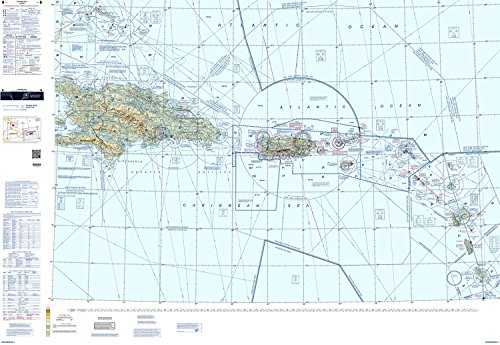
Caribbean VFR Aeronautical Chart for Pilots
Explore the vibrant and breathtaking Caribbean region with the Caribbean VFR Aeronautical Chart, the ultimate essential for pilots flying in this tropical paradise. Designed specifically for Visual Flight Rules (VFR) pilots, this comprehensive chart offers detailed and up-to-date information on airspaces, airports, heliports, communication frequencies, navigation aids, and more. With this chart in your cockpit, you can confidently navigate the skies and enjoy the beauty of the Caribbean from above.
Accurate and Reliable Navigation
Featuring precise and reliable information, the Caribbean VFR Aeronautical Chart ensures pilots can navigate the complex airspace of the region with ease. With detailed depictions of restricted areas, controlled airspace, and mandatory reporting points, you can ensure compliance with local regulations and safely navigate around potential flight obstacles. The chart also provides critical information on navigation aids, such as VORs, NDBs, and GPS waypoints, helping you maintain a consistent course throughout your journey.
Comprehensive Coverage and Updated Data
With its extensive coverage, the Caribbean VFR Aeronautical Chart encompasses multiple countries and territories, including popular destinations like Jamaica, Barbados, the Bahamas, and more. The chart is regularly updated to ensure accuracy and to incorporate any changes in airspaces, airport facilities, or navigation aids. This ensures that you have the most up-to-date information at your fingertips, allowing you to plan your flights with confidence and make informed decisions while in the air.